
Hurricane Hermine to bring late-night wind, heavy rain to Albany area
With 80 mph winds, Hermine first Florida hurricane in nearly 11 years
By Jim Hendricks and Terry Lewis
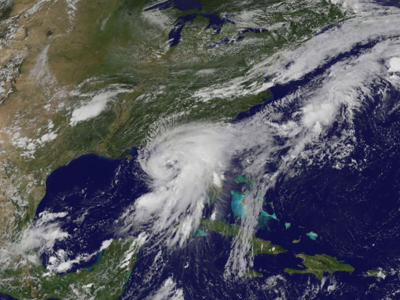
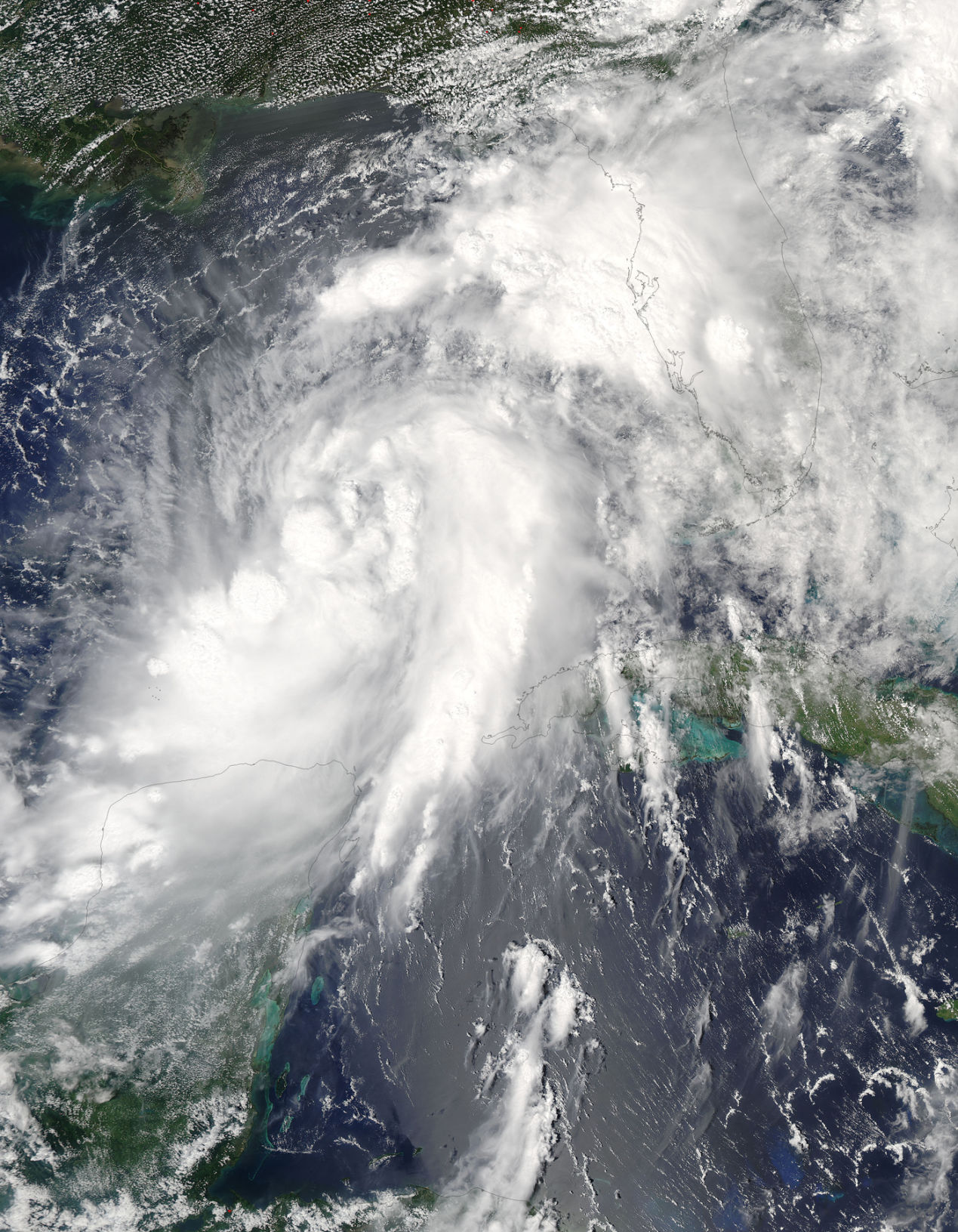
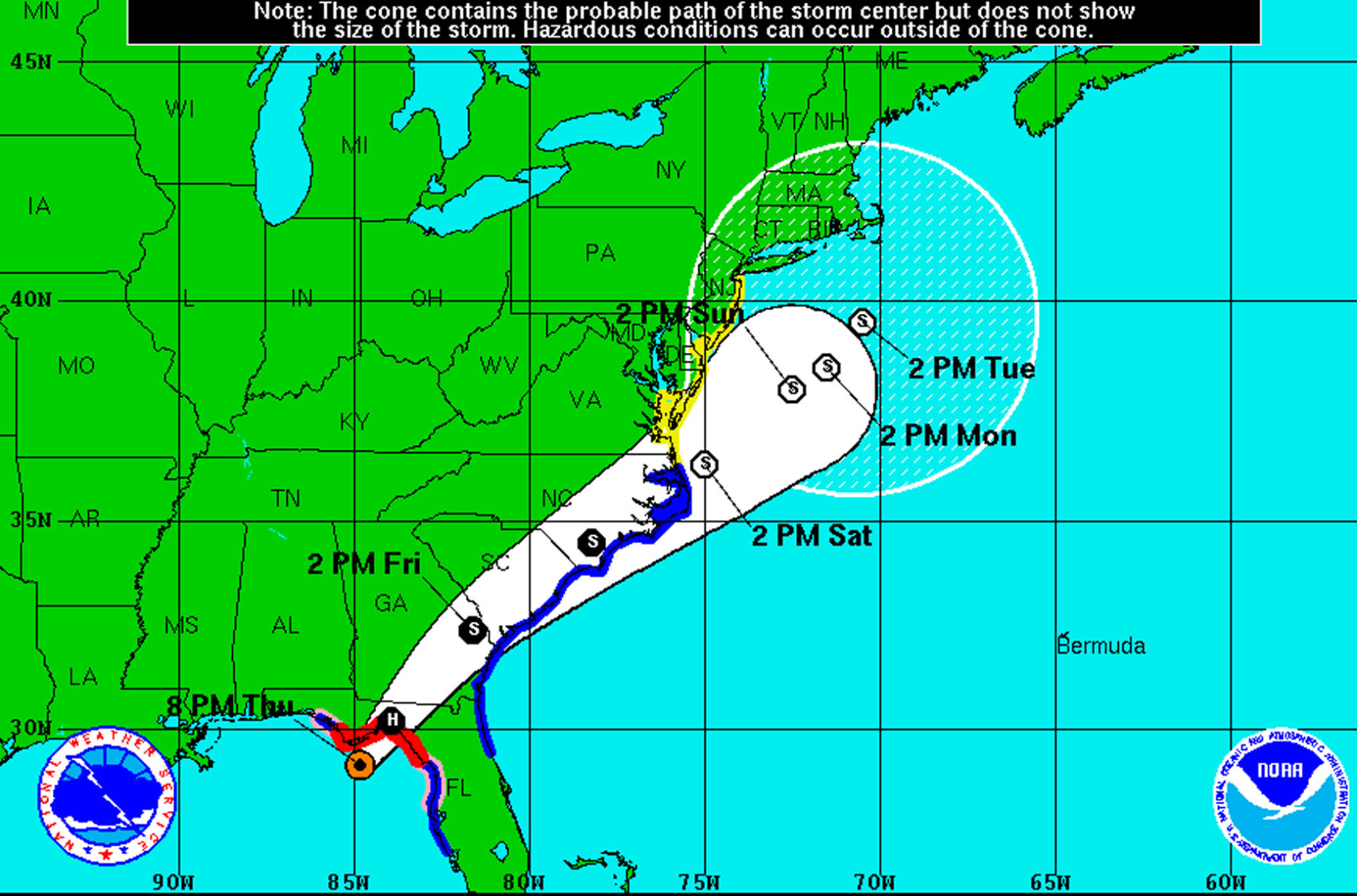
ALBANY — Heavy rainfall and tropical storm force gusts will hit the metro Albany area late tonight as Hurricane Hermine, the first hurricane to make landfall in Florida since Wilma in 2005, storms into the Big Bend as a category 1 cyclone.
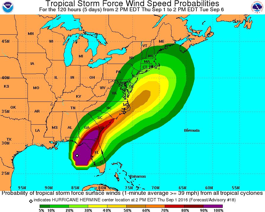
“The timing for that is after 2 o’clock and until about 8 o’clock in the morning (Friday),” Don Harrigan, a meteorologist with the National Weather Service office in Tallahassee, said. There won’t be sustained winds of tropical storm force, but the gusts will be “probably topping out in the 40 mph range,” he said.
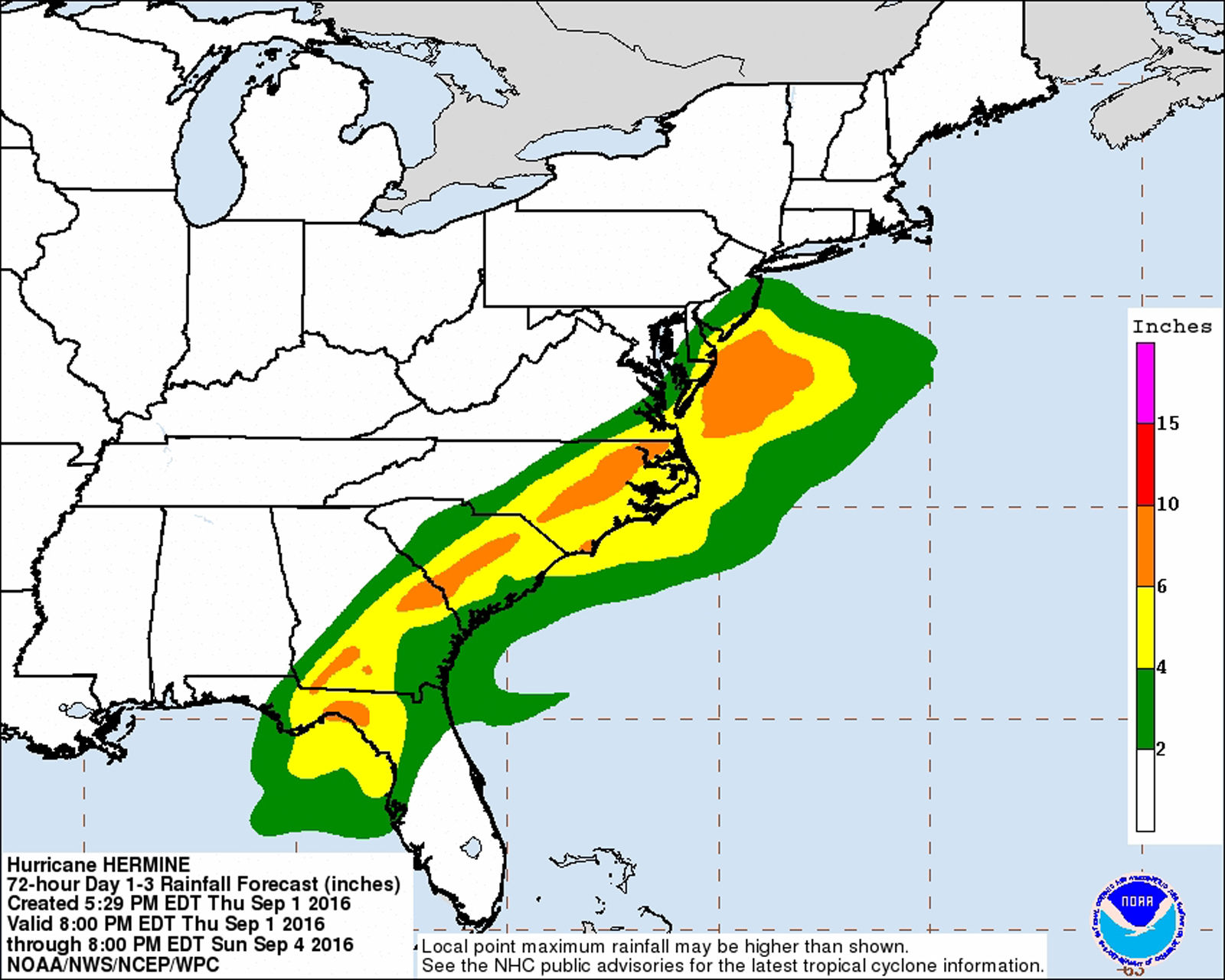
Rainfall totals, according to the latest forecast, will vary depending on location. “We’re still looking in the 3-6 inch window for Dougherty County,” Harrigan said, adding that some locations could see “isolated amounts of up to 10 inches.”
“That, again, is going to fall around midnight and in the morning,” he said.
Ron Rowe, Albany fire chief and emergency management director for Dougherty County, said public safety officials were bracing for the storm.
“Right now we are just doing typical prep work and getting ready for 30-40 mph winds and 3 to 5 inches of rain,” he said. “The roadways that typically hold water during a storm will get it again, plus we’ll have some flash flooding in low-lying areas.
“We’re a tree city, so we’ll probably have some trees and limbs down along with a few power outages.”
The prospects of heavy rain and winds, particularly in the early hours when students would be heading to school, prompted Dougherty and Lee County school administration officials to call off school Friday. Deerfield-Windsor School and Sherwood Christian Academy also were to be closed Friday.
Several area public school systems also confirmed closures, including Worth, Calhoun, Mitchell, Tift, Decatur and Baker counties.
Albany State University, Darton State College, Albany Technical College, Abraham Baldwin Agricultural College in Tifton and Valdosta State University are closing for the storm as well.
Health departments and programs in the following counties will be closed all day Friday: Colquitt, Decatur, Grady, Mitchell, Seminole, Thomas and Worth counties. Health departments and programs opening at noon Friday are Baker, Calhoun, Dougherty, Early, Lee, Miller and Terrell counties.
Georgia Department of Transportation officials are mobilizing ahead of the storm and are urging motorists to take caution when traveling in the stormy weather.
“We urge motorists to pay attention to warnings and advisories to stay off the roads due to the potential for flash flooding and downed trees,” GDOT Maintenance Engineer Dale Brantley said. “Our crews will work quickly to remove any dangers from the roadway, but we need to be able to get to trouble spots quickly.”
GDOT crews in Southeast and East Central districts were to be out beginning late Thursday night, while crews in the Southwest District were to be on standby as of midnight Thursday.
The uncertain weather led to the postponement of several other events in Albany, including a visit by State School Superintendent Richard Woods. The Georgia Department of Education said the visit would be rescheduled.
In addition, Kay Hind, executive director of the SOWEGA Council on Aging, said all of the seniors centers within its 14-county coverage area would be closed Friday because of the weather. Since many seniors utilizing the centers depend on the daily meals provided there, officials are making meal deliveries today so they have something they can eat tomorrow while the centers are closed.
Shortly before 3 p.m. Thursday, National Hurricane Center reported that Air Force hurricane hunter aircraft had determined that Hermine was packing winds of 75 mph, making it the fourth Atlantic hurricane this season.By 8 p.m., the wind speed was 80 mph.
The last hurricane to make landfall in Florida was Wilma, which struck in October 2005. Wilma was a monster category 5 cyclone, however, and Hermine is not expected to be more than a relatively weak category 1 hurricane.
“We’ve been lucky,” Harrigan said of the nearly 11-year period without a hurricane landing. “Hopefully, this one doesn’t do too much damage.”
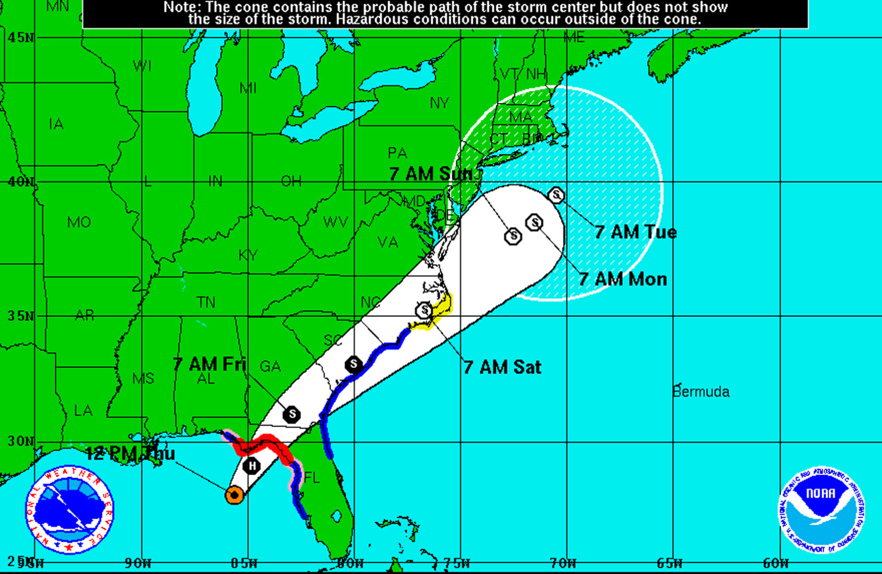
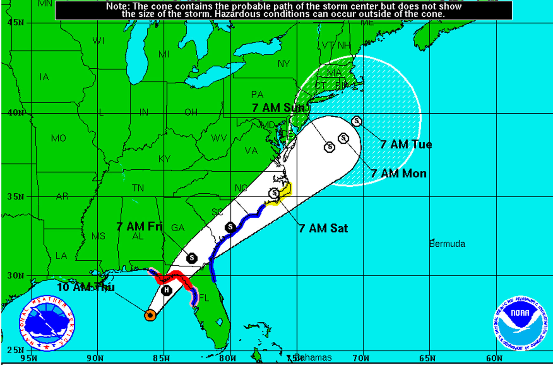
Mid-afternoon, buoys off the Florida west coast were registering 50 mph winds. “That hasn’t quite reached the land area yet,” Harrigan said. He said landfall was expected to occur sometime between 10 p.m. today and 1 a.m. Friday.
The more severe weather is expected to come to the east of the hurricane. This morning, the National Hurricane Center issued a hurricane warning for the area of Florida from Mexico Beach to the Suwannee River, with a hurricane watch continuing outward from that area to the Anclote River and Destin.
Southwest Georgia, including all of metro Albany, was placed on a tropical storm warning this afternoon.
This is historically the most active period of the Atlantic hurricane season, which started June 1. The storm season continues through Nov. 30.

Related Articles
Federal agency to investigate Monday paragliding fatality
The death of a 63-year-old man who was killed in a paragliding accident on Monday is under investigation by the National Transportation Board, according to Dougherty County Coroner Michael Fowler.
Audit of police surveillance cameras results in arrests of five former APD officers
“The bottom line is when we find people who have misused resources that they have, we’re going to hold them accountable. These resources help fight crime, but we will not tolerate when they are misused.”
New commander takes helm as Marine Corps logistics adapts to evolving battlefield
Brig. Gen. Kevin G. Collins assumed command of Marine Corps Logistics Command during a change of command ceremony at Marine Corps Logistics Base Albany, succeeding Maj. Gen. Keith D. Reventlow after four years leading the organization responsible for sustaining Marine forces around the globe.
