
Officials say Albany, Dougherty spared from worst of latest storm system
Tornadoes, large hail hit southwest Alabama, counties surrounding Dougherty
By Jim Hendricks
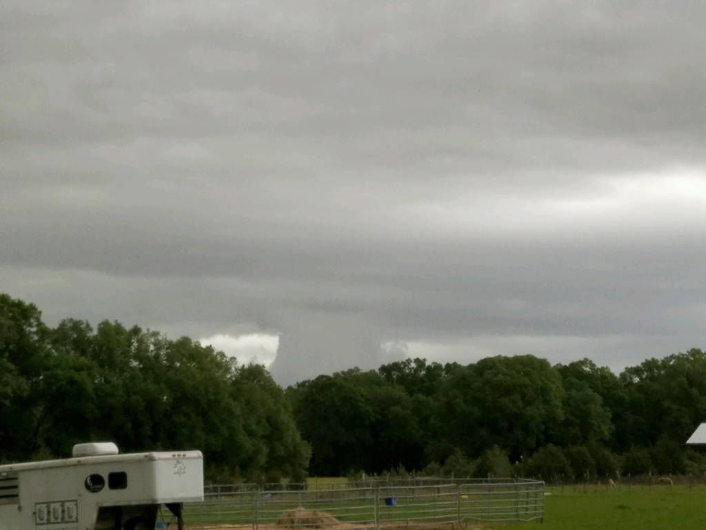
ALBANY — Storm-weary Southwest Georgians hunkered down Wednesday afternoon for another round of violent storms. A string of storms rolled through in the pre-dawn hours, but the weather system that was expected to be more severe reached Dougherty County shortly after 2:30 p.m.
The system lived up to warnings that were issued by National Weather Service forecasters. Strong tornadoes were spotted at 1:28 p.m. near Americus and at 2:12 p.m. near Vienna. National Weather Service officials will be surveying those reports Thursday, as well as possible twisters in Quitman, Stewart, Clay and Randolph counties. Other dangerous hazards associated with the storm were hail up to 2 inches in size and wind gusts of 60 mph or better.
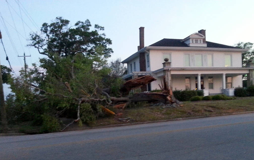
With many residents still recovering from January storms and tornadoes, Wednesday’s event was more to endure.
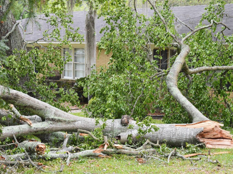
“I have to admit that this whole storm thing is getting to be discouraging,” Carl Jones said in reference to a system that moved through the region Monday, downing a tree in his yard and damaging a number of nearby trees and houses, as Wednesday’s more severe storm system neared.
“Four storms in a little over three months is hard to take,” the Whispering Pines Road resident said. “Every storm that has come through seems to do the same thing. It’s almost like we’re hamsters in an exercise wheel. And it is discouraging, but FEMA is helping us get it cleaned up. I just wonder how much more we are supposed to take. But we are only as strong as the collective.”
Despite a growing sense of fear in the community as dark clouds, lightning and heavy rains moved through mid-afternoon, at 5 p.m. Wednesday Dougherty County Emergency Management Agency Director Ron Rowe said the news was good for a community that had been devastated by powerful storms in January that had damaged hundreds of homes and done tens of millions of dollars worth of damage.
“As of right now, we’ve missed out on everything,” Rowe said from a county Emergency Operations Center at Honeysuckle Drive. “We’re still under a tornado watch until 8 p.m., but so far we have no reports of any damage, thank goodness.”
Rowe did say, however, that a large number of citizens in the community took advantage of shelters that opened at four churches and two high schools in the county.
“I don’t want to analyze anybody because I’m not qualified to do that, but it’s almost like a lot of folks in our community are going through some level of post-traumatic stress disorder (from the January storms),” the EMA director said. “We had 221 of our citizens take advantage of the shelters that were open.
“Again, I’m not making a diagnosis, but there are a lot of people in this community who are still scared. You can see it in their faces.”
Weather forecasters had said the more violent storms would start coming through sometime between 1 p.m. and 3 p.m. Wednesday. Temperatures dropped appreciably and winds picked up as the skies, which had been sunny for part of the morning, blackened and lightning streaked through the sky, followed by rumbling thunder.
The Weather Service said in its forecast discussion Wednesday that the risk of large hail in the area was 45 percent, with a tornado risk of 15 percent, both significant percentages. Social media reports said hail as large as an inch to 2 1/2 inches had been experienced in southeast Alabama.
With the morning round of storms Wednesday, Rowe had expressed concern around midday Wednesday that residents would think the worst was over. Just under a half-inch of rain accumulated at the NWS reporting station at the Southwest Georgia Regional Airport between 4 a.m. and 7 a.m. The station recorded less than a tenth of an inch during the afternoon.
“The downside of this thing is that we had some storms come through this morning and a lot of people panicked thinking that was the main event, but that was just rain with some thunder and lightning,” Rowe said. “Now we have this lull, but if you walk outside you can feel how hot it is.
“What is happening is we have two major fronts, a warm front and a cold front, that are going to collide right above us. When hot air and cold air meet, that equals tornadoes, or at least severe weather.”
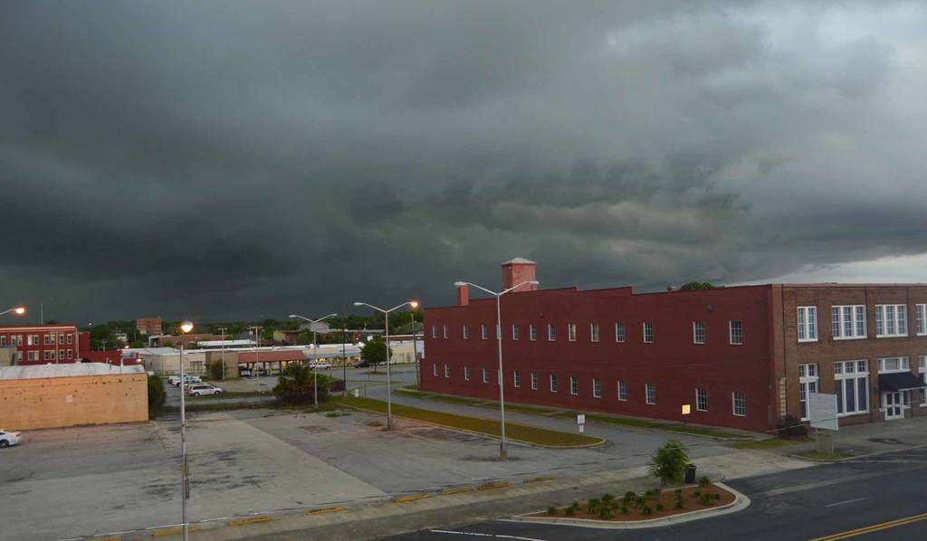
When the system moved in, the airport weather station showed the temperature quickly dropped 9 degrees to 73, with winds increasing to 20 mph with gusts of 28 mph by 3 p.m. By 5 p.m. the temperature had dropped further to 65 degrees.
By 4 p.m., skies had brightened but were still overcast before darkening again around 5 p.m. National Weather Service officials said the primary concern at that point was from the part of the storm system that had been moving slowly off the Gulf of Mexico.
“Those cells are feeding off the Gulf, and they’re moving northeast,” NWS meteorologist Ricardo Humphreys said. “It looks like they’re staying together.”
Humphreys said it appeared that the storm cells would move through the Albany area by 7:30 p.m.-8 p.m., after which the area would be more likely to see isolated thunderstorms. But he said residents should still exercise caution.
“Conditions are still favorable for tornadoes,” Humphreys said of Wednesday night’s weather.
City Manager Sharon Subadan told the Albany Utility Board at its meeting early Wednesday morning that line crews had worked around the clock Monday to restore power outages and clear fallen debris from roadways in advance of Wednesday’s storm.
“We’re prepared, we’re ready for what’s coming later today,” she said. “We had a couple of crews come in from out of town to help us Monday, and we held onto them. We’ve tried to work it so our line crews would have an opportunity to rest before the storm hits us this afternoon. The latest forecast we’ve gotten says this system looks pretty formidable.”
Dougherty County officials activated Emergency Operations Centers in the downtown Courthouse building and at 115 Honeysuckle Drive after a local state of emergency was declared by Dougherty County Commission Chairman Chris Cohilas late Tuesday. Non-emergency lines at the EOC are (229) 483-6226 and (229) 483-6227
The State Operations Center in Atlanta was open and operating in 12-hour shifts, around the clock. FEMA Region IV has also opened a regional coordination center in Atlanta to provide assistance to the states impacted by the storm system.
More than half the state — 91 counties, including Southwest Georgia — were under a hazardous weather watch.
Albany city, Dougherty County and Lee County non-essential offices closed at noon, though all public safety services were available. Albany Transit was continuing to function on normal transit routes. All 17 county health departments in the Southwest Health District that includes the five metro Albany counties closed at 10 a.m.
Public and private schools in Dougherty County and the counties contiguous to it that were not already out on spring break were closed Wednesday. Classes at Albany State University, Albany Technical College and Georgia Southwestern State University also were canceled.
Storm shelters in Albany were open at the Albany Family Worship Center (3024 Kensington Court), Cutliff Grove Baptist Church (835 W. Broad Ave.), Byne Memorial Baptist Church (2832 Ledo Road), Victory Tabernacle Church (3250 Sylvester Road), Westover High School (2600 Partridge Drive) and Dougherty High School (1800 Pearce Avenue).
In addition to Byne Church, Lee County officials said First Baptist Church of Leesburg on Main Street was to open a shelter if required by conditions.
Thursday’s weather is expected to be a sharp contrast from Monday and Wednesday. With a 30 percent chance of rain and isolated thunderstorms overnight and through 8 a.m., clearing should then begin in the morning hours. The forecast calls a breezy day, with winds of 15-25 mph, and sunny skies. Temperatures will be cooler under sunny skies, with a high of 68 expected. Lows Thursday night and heading into the weekend are forecast to be in the 40s.
Terry Lewis, Jon Gosa and Carlton Fletcher contributed to this report.
Related Articles

Dougherty Jail graduates first class of female GED recipients
“It was an escape. I can say this has been challenging. I want to express my gratitude for being able to attend this program.”

From cotton to cloud: In the data center debate, is rural Georgia once again being asked to carry the cost?
Across much of rural Georgia, the abandoned cotton warehouses and shrinking tax bases remain — enduring reminders that industries built to serve distant markets do not necessarily stay rooted in the communities that first sustained them.
Dawson Council approves $400,000 lifeline in emergency meeting as financial accountability remains elusive
Less than a week after city officials publicly acknowledged the City of Dawson cannot continue operating without additional financing, the Dawson City Council convened a hastily called emergency meeting Tuesday evening and unanimously approved authority to borrow up to $400,000 through a tax anticipation note.
